

Top Urban Mapping Tools Every Urban Planner Needs
A practical rundown of the best urban mapping tools for planners, covering GIS, visualization, data, and 3D modeling platforms, with notes on free versus paid options.
 Elif Ayse Sen2 January 20255 Mins read661

Table of Contents Show
Urban mapping tools are the GIS, visualization, and geospatial data platforms that planners use to analyze land, model growth, and design cities. The best urban mapping tools range from free open-source options like QGIS and OpenStreetMap to commercial platforms such as Esri ArcGIS, Mapbox, and UrbanFootprint, each built for a different part of the planning workflow.
As cities grow denser and datasets get bigger, planners need software that turns raw spatial data into decisions about land use, transit, housing, and climate risk. This list covers nine tools worth knowing, what type of platform each one is, and where it fits. If you are just getting started with spatial work, our overview of architecture and urban mapping is a useful companion read.
What Are Urban Mapping Tools?
Urban mapping tools are software platforms that collect, analyze, and display geographic data about a city. Some are full geographic information systems (GIS) for spatial analysis, some are visualization engines for large datasets, and others are data sources or scenario planners. Most projects use two or three together rather than a single tool, since land use analysis, 3D modeling, and public dashboards each call for different strengths.
💡 Pro Tip
Before committing a whole team to a paid license, prototype your workflow in QGIS. If a project only needs base maps, buffer analysis, and clean exports, an open-source stack often covers it, and you can reserve commercial seats for the staff who genuinely need advanced geoprocessing.

Top Urban Mapping Tools Every Urban Planner Should Use
The tools below are grouped loosely from general-purpose GIS to specialist modeling and data platforms. Each entry notes whether it is free, open-source, or paid, so you can match it to your budget.
1. QGIS
QGIS is a free, open-source GIS that has become the default entry point for spatial analysis. It reads shapefiles, GeoJSON, GeoPackage, and raster formats, and its plugin library adds everything from automated geoprocessing to 3D views. For planners, QGIS handles land use mapping, zoning overlays, and demographic joins without a license fee. The active community means bugs get patched quickly and documentation stays current. See the project at qgis.org.
2. Esri ArcGIS
Esri ArcGIS is the industry standard in professional planning offices. The desktop application ArcGIS Pro pairs with ArcGIS Online for cloud storage, public web maps, and StoryMaps that non-technical stakeholders can read. Its analysis toolbox is deep, covering network analysis, suitability modeling, and spatial statistics. ArcGIS is paid and priced per seat, but many city departments already run it, which makes data sharing easier. Details are at esri.com.
3. Mapbox
Mapbox is a developer-focused platform for custom, interactive maps that live inside websites and apps. Planners use it to publish attractive base maps, style vector tiles, and embed live data for public consultation portals. It offers a free tier with generous usage limits, then moves to usage-based pricing. Mapbox pairs well with a GIS: you analyze in QGIS or ArcGIS, then present through Mapbox.
4. Kepler.gl
Kepler.gl is a free, open-source visualization tool built by Uber for large geospatial datasets. Drop in a CSV of trips, sensor readings, or building points and it renders animated heatmaps, arcs, and 3D hexbins in the browser with no coding. It is not a full GIS, so use it for exploring movement and density patterns rather than editing geometry. Try it at kepler.gl.
📌 Did You Know?
OpenStreetMap is maintained by more than 10 million registered contributors worldwide, according to the OpenStreetMap Foundation. That community-edited dataset now underpins routing, base maps, and analysis in a large share of the other tools on this list, including Mapbox and many QGIS plugins.
5. OpenStreetMap
OpenStreetMap (OSM) is not software so much as a free, editable map of the world built by volunteers. For planners it is a data source: roads, buildings, land use, and points of interest that you can download and load into any GIS. In cities where official data is thin or expensive, OSM often fills the gap. Access and edit the map at openstreetmap.org.
6. CARTO
CARTO is a cloud-native platform for spatial analysis and visualization that runs on top of data warehouses. It suits teams that already store data in the cloud and want dashboards, site selection models, and spatial SQL without managing servers. CARTO is paid, with plans aimed at organizations rather than individuals. It shines for accessibility and location intelligence work. Learn more at carto.com.
7. Google Earth Engine
Google Earth Engine gives planners access to decades of satellite imagery and a cloud engine to analyze it at scale. It is the tool of choice for tracking urban expansion, measuring green cover, mapping heat islands, and monitoring change over time. Access is free for noncommercial and research use, with paid tiers for commercial projects. It rewards some coding comfort. Start at earthengine.google.com.
8. UrbanFootprint
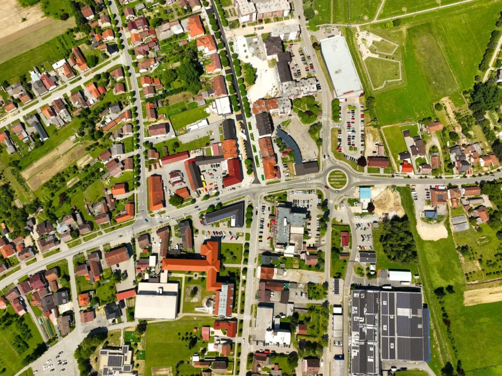
UrbanFootprint is a paid urban planning platform built specifically for scenario modeling. Planners test how different land use plans affect transportation, housing, emissions, and climate risk, using hundreds of preloaded datasets. It answers policy questions directly rather than asking you to assemble the analysis yourself, which saves time on long-range plans and resilience studies. See the platform at urbanfootprint.com.
9. Rhino and Grasshopper
For 3D urban form and parametric design, planners and urban designers turn to Rhino with its Grasshopper plugin. Rhino handles precise 3D geometry, while Grasshopper drives generative and rule-based city modeling, from massing studies to solar and daylight tests. Both are paid, though Grasshopper ships free with Rhino. This pairing bridges design and analysis when a project needs form, not just data. Find them at rhino3d.com. For terrain-driven work, our guide to online 3D terrain mapping tools is a good next step.
How the Urban Mapping Tools Compare
The table below sorts each tool by type and its strongest use case, so you can shortlist quickly. For a deeper look at the GIS side, our roundup of architecture mapping GIS tools and resources goes further.
| Tool | Type | Best for |
|---|---|---|
| QGIS (free, open-source) | GIS | Land use mapping and spatial analysis on any budget |
| Esri ArcGIS (paid) | GIS | Professional offices needing deep analysis and data sharing |
| Mapbox (freemium) | Visualization | Custom interactive maps for websites and consultation |
| Kepler.gl (free, open-source) | Visualization | Fast visuals of movement and density from big datasets |
| OpenStreetMap (free, open data) | Data | Free base data on roads, buildings, and land use |
| CARTO (paid) | Visualization and analysis | Cloud dashboards and location intelligence for teams |
| Google Earth Engine (free tier) | Data and analysis | Satellite analysis of urban growth and green cover |
| UrbanFootprint (paid) | Data and scenario planning | Long-range land use and climate scenario modeling |
| Rhino and Grasshopper (paid) | 3D modeling | Parametric urban form and massing studies |
🔢 Quick Numbers
- QGIS is released under the GNU General Public License, meaning it is free to use with no per-seat cost, per the QGIS project.
- OpenStreetMap passed 10 million registered contributors, according to the OpenStreetMap Foundation.
- Google Earth Engine hosts a public data catalog of more than 90 petabytes of imagery, according to Google Earth Engine documentation.
How to Choose the Right Urban Mapping Tool
Start with the question you need to answer, not the software. If the task is land use analysis or zoning, a GIS like QGIS or Esri ArcGIS is the base. If you need to present data to the public, add a visualization layer such as Mapbox or CARTO. For growth and climate scenarios, UrbanFootprint or Google Earth Engine carry the load, and Rhino with Grasshopper covers 3D form.
Budget matters too. Open-source urban mapping tools like QGIS, Kepler.gl, and OpenStreetMap cost nothing and cover a surprising amount of everyday work, while paid platforms earn their price through support, advanced analysis, and easier collaboration across a department. Match data accuracy, file compatibility, and the learning curve to your team before you buy. Planners looking for lighter field tools can also review the best mobile apps for architects. For professional standards and continuing education, the American Planning Association is a reliable reference, and the background on geographic information systems is a solid primer for newcomers.

Where to Go From Here
Your Next Step: Pick one free tool and one paid tool from this list that match your current project, install QGIS today, and rebuild a recent map in it. Working through a real dataset teaches you more about which urban mapping tools fit your team than any feature comparison can.








Famous Sustainable Buildings: 6 Green Skyscrapers Leading the Future
From Milan's Bosco Verticale to Sydney's record hybrid timber tower, six green...
 Furkan Sen6 Mins read

Best Orientation for a House: Why North Orientation Matters
North orientation shapes a home's light, warmth, and running costs, and its...
Furkan Sen6 Mins read

Passive Design Architecture: A Practical Guide to Low-Energy Buildings
Passive design uses a building's orientation, form, and materials to control heat,...
Furkan Sen8 Mins read

Passive House vs LEED Certification: Which Green Standard Should You Pursue?
Passive House focuses on strict energy performance and airtightness, while LEED scores...
 Sinan Ozen8 Mins read


Leave a comment