

AI and Satellite Imagery In Smart City Development

Table of Contents Show
Cities are complex ecosystems, constantly changing and adapting to the needs of their inhabitants. In recent years, a new wave of innovation has begun to influence how we understand and shape these urban spaces. Rather than focusing solely on physical infrastructure, forward-thinking cities are turning to digital tools that offer a clearer, more dynamic picture of urban life. At the core of this evolution are two powerful forces: artificial intelligence and satellite imagery.
Together, they are changing the way cities are planned, monitored, and managed. Satellite data provides a wide-angle view of everything from land use to environmental change, while AI brings the speed and intelligence needed to interpret it. Urban planners, researchers, and policymakers now rely on freely accessible resources like Sentinel-2 images for download, which provide the detailed and timely information required to make smarter decisions. This combination of technology is not just improving cities but redefines what is possible within them.
What is a Smart City?
A smart city is not measured by how many sensors it has or the number of apps it offers. It is defined by how seamlessly technology helps improve daily life. This kind of city pays attention to its surroundings, gathering information from buildings, streets, and residents, then using that knowledge to create smoother, safer, and more sustainable living conditions.
At its heart, a smart city is built on connection. Data moves between systems that once operated separately, uncovering patterns and opportunities that were previously hidden. The result is not a futuristic skyline, but a more thoughtful and responsive urban environment. Public services become more efficient, resources are managed with care, and the well-being of both people and the planet becomes a shared priority.
The Power of Satellite Imagery in Urban Planning
Cities are living systems, constantly evolving in response to human activity, environmental pressures, and policy decisions. For urban planners, staying ahead of this change means looking beyond traditional maps and on-the-ground surveys. Data from space, including Sentinel satellite imagery, offers a powerful vantage point, delivering timely and detailed snapshots of urban environments from above. This perspective allows planners to observe the full scale of a city’s growth and transformation in ways that would be impossible from street level.
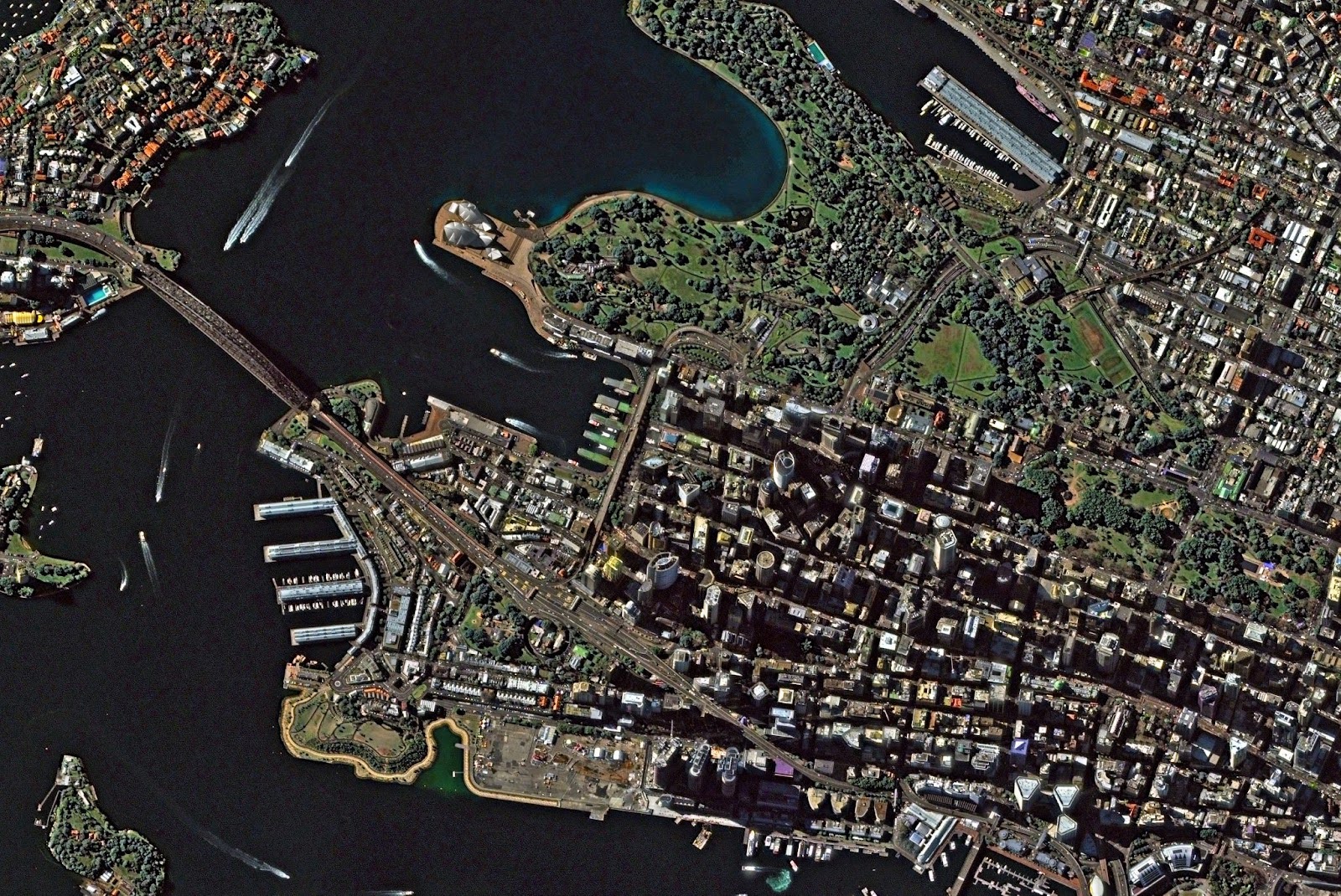
Satellite imagery helps monitor land use changes and infrastructure development with unmatched consistency. Planners can track the spread of residential zones, commercial hubs, and transportation corridors, gaining early insight into how development is unfolding. It also plays a key role in environmental monitoring. By analyzing vegetation indices and surface reflectance, planners can track the loss or recovery of green space, detect signs of land degradation, and monitor the health of urban ecosystems. Satellite data is equally useful for identifying urban heat islands: dense, built-up areas that retain heat and contribute to rising temperatures in cities. With this knowledge, cities can implement targeted climate adaptation strategies, such as planting trees or redesigning public spaces.
Furthermore, satellite imagery enables the detection of illegal construction, land encroachments, and unregulated activity that may go unnoticed by local authorities. It also aids in forecasting urban expansion and traffic congestion, helping governments plan for future infrastructure needs rather than reacting to overcrowding after the fact. With tools like Sentinel-2 data, planners have access to high-resolution, multispectral data that captures both the visible and invisible shifts in the urban landscape.
Turning Images into Actionable Insights
The value of satellite imagery multiplies when paired with artificial intelligence. On its own, an image is just a collection of pixels. But with AI, those pixels become data points that are analyzed, categorized, and interpreted at a scale far beyond human capacity. AI can scan thousands of images in minutes, detect patterns, highlight anomalies, and track changes over time with remarkable precision.
In urban planning, this means AI can automatically map the expansion of roads, identify where green space is being lost, and flag new structures that have appeared between image captures. It can even estimate the pace of urban sprawl and project likely future growth. AI helps cities model heat distribution to plan better ventilation corridors, monitor impervious surfaces that increase flood risk, and evaluate the impact of new developments on surrounding areas. These capabilities are essential for making proactive, data-driven decisions.
Real-World Applications
In practice, cities around the world are already using the combined power of satellite imagery and AI to make better decisions and design more resilient communities. For example, coastal cities use satellite data to monitor erosion and rising sea levels, allowing for smarter zoning and coastal defense planning. In regions with rapid urbanization, local governments rely on satellite-based insights to keep track of informal settlements and manage unplanned expansion. In cities struggling with pollution or heat, planners analyze vegetation cover and surface temperature maps to guide tree planting, green roofing, and other climate-mitigation efforts.
Traffic congestion, a common issue in nearly every major urban center, is being tackled using predictive modeling based on satellite-observed land use patterns. By understanding how neighborhoods are growing and where people are moving, cities can optimize transit routes and infrastructure investments. In regions vulnerable to natural disasters, satellite imagery supports early warning systems, post-event damage assessments, and long-term resilience planning.
EOSDA LandViewer is among platforms that play a key role in making these solutions accessible. By offering a smart but friendly interface for exploring and analyzing satellite data, it bridges the gap between complex remote sensing technology and the everyday needs of urban professionals. With built-in support for Sentinel-2 imagery, the platform enables users to gain deep insights into urban dynamics without requiring advanced technical expertise.
In general, transforming raw satellite data into digestible insights, AI allows planners to focus on strategy rather than data processing. It becomes easier to test urban design ideas, simulate outcomes of policy changes, and measure the effectiveness of interventions.


The Nano Banana Prompt: Mastering Micro-Bionic Architecture in Midjourney v6
Table of Contents Show 1. Deconstructing the “Nano Banana Prompt” Logic2. Parametric...

ChatGPT Alternatives for Architects: 8 Best AI Tools in 2026
Not every AI assistant fits an architecture workflow the same way. This...

Spacio AI Review: Generate Structured Building Proposals in Minutes, Not Weeks
This Spacio AI review breaks down how the platform handles early-stage building...

Midjourney Architecture Guide: AI-Generated Renderings with DALL-E and Stable Diffusion
A practical breakdown of Midjourney, DALL-E, and Stable Diffusion for architectural visualization....

Leave a comment