

Drones on Day One: The Case for Aerial Mapping Before Groundbreaking

Most construction projects get their first drone flight weeks or months after mobilization begins. By then, the site has already been disturbed, earthworks are underway, and whatever the ground looked like before anyone touched it exists only in memory. That baseline is gone.
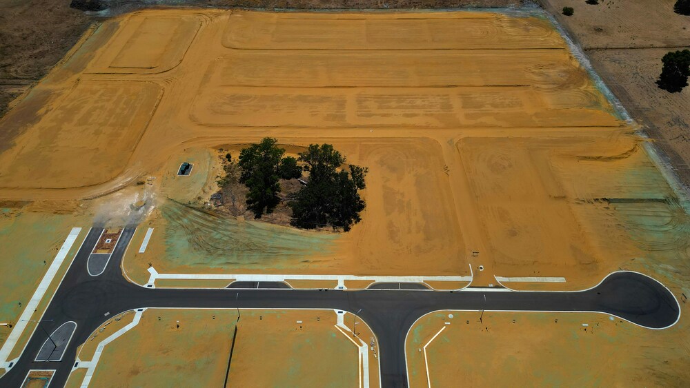
The push to deploy aerial mapping earlier in the project lifecycle has grown steadily as teams recognize how much useful intelligence a pre-construction survey actually provides. Topography, drainage patterns, existing structures, vegetation cover, buried utility indicators, access constraints, and accurate elevation data across the entire site: all of this can be captured before a single machine moves. The question is why so many projects still skip it.
The Problem Starts Before Groundbreaking
Surprises during construction are expensive. A peer-reviewed study published in the ASCE Journal of Management in Engineering, analyzing 318 change order documents across infrastructure projects in Peru, found that inaccurate site information was among the most frequently occurring risks leading to delays and cost overruns. Alongside adverse weather and approval delays, unforeseen site conditions consistently drove budget and schedule divergence from plans.
This is not a regional problem. Cross-industry analysis of construction cost overruns repeatedly identifies the same root causes: inaccurate estimates at design stage, errors and omissions in planning, and site conditions that differed materially from what was assumed when the contract was signed.
A separate study published in MDPI Sustainability, examining 212 construction projects to identify key structural factors behind construction cost overruns, found that project management failures and resource planning issues, frequently driven by poor pre-construction intelligence, accounted for the most significant cost drivers across project types.
The implication is straightforward: a substantial share of overruns trace back to decisions made before construction started, based on site information that was incomplete, outdated, or simply wrong.
What Aerial Mapping Captures That Other Methods Miss
Traditional site surveys conducted by ground crews are accurate within their scope, but limited in coverage and speed. A single total station setup captures points in sequence. Large, irregular, or obstructed terrain takes days. The output is precise at measured locations and interpolated everywhere else.
UAV-based photogrammetry works differently. A drone equipped with a high-resolution camera and RTK positioning can cover several acres in a single flight, generating thousands of overlapping images that photogrammetry software stitches into georeferenced orthomosaics, digital terrain models, and 3D point clouds. The spatial coverage is continuous, not sampled. Elevation data exists across the full site footprint, not just at surveyed points.
A comprehensive review of UAV applications in construction monitoring and inspection, published in the MDPI journal Drones by researchers at Kyungpook National University, found that drones provide significant efficiency advantages over conventional point-based survey methods for construction applications, particularly for earthworks and large-scale site characterization.
The review also highlights that UAV integration with BIM workflows enables direct comparison of aerial as-built data against design models, which is precisely the value proposition for pre-construction baseline capture.
Drone mapping software designed for construction operationalizes this by connecting aerial survey outputs to floor-level documentation, BIM comparisons, and field observations in a single project record rather than a standalone survey platform.
The baseline flight creates a reference that every subsequent survey can be measured against. When the earthworks contractor removes fill from one area and moves it to another, the volume calculations are grounded in documented reality rather than estimated starting grades. When a subcontractor disputes how much material was on site at mobilization, there is a timestamped 3D record.
The Timing Advantage
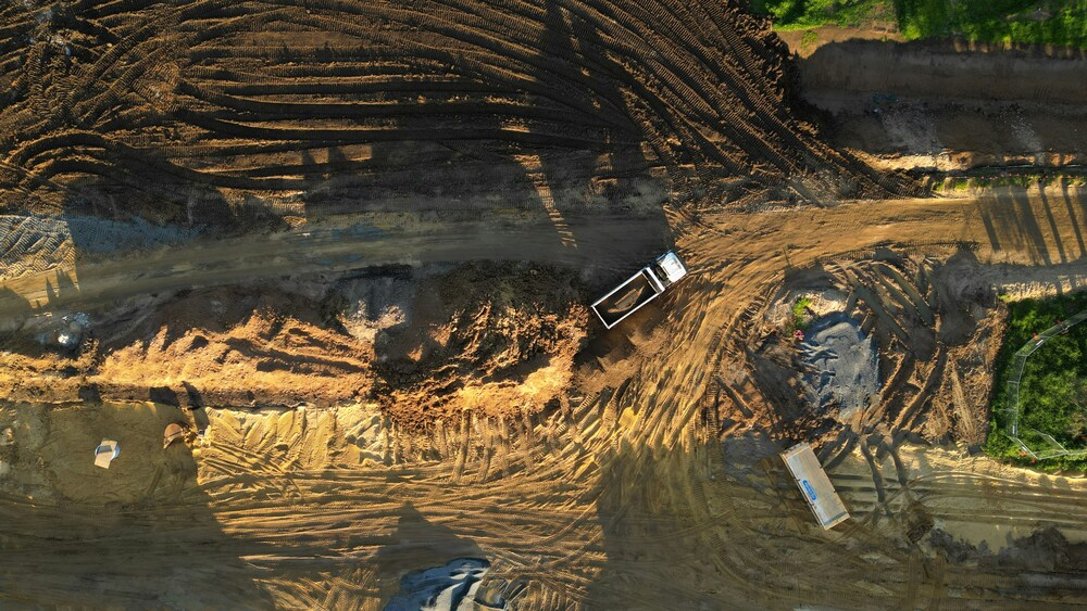
Pre-construction aerial mapping has a quality that no other site documentation can replicate: it records conditions that no longer exist once work begins. Topsoil depth, undisturbed drainage channels, the exact position of existing vegetation, the actual grade before any cuts or fills: these facts are available for precisely one window of time.
Once mobilization starts, that window closes. Equipment tracks compress soil. Temporary roads alter drainage. Stockpiles obscure underlying grades. The site has changed, and the question of what it looked like before becomes a matter of interpretation and dispute rather than documented record.
Construction teams that fly the site before any ground disturbance take that uncertainty off the table. They have a defensible baseline. Every change order claim that depends on original site conditions has an answer. Every volume dispute references measured data.
This matters most on projects where site conditions are likely to influence scope, and those tend to be exactly the projects where disputes arise.
The Case Is Simple
Aerial mapping before groundbreaking costs relatively little. A single UAV flight over an undisturbed site takes hours, not days, and produces data that remains relevant throughout the project’s life. The alternative is beginning construction without a verified baseline and hoping the assumptions baked into the design hold up once the site is actually dug.
They often do not. The cost of inaccurate site information has been documented repeatedly across project types and geographies. Pre-construction aerial mapping is one of the most direct interventions available for reducing that exposure, and the only time it can be done is before the excavators arrive.


Sydney’s Buildings Are Ageing Faster Than Most Owners Realise
There is a wave of building deterioration moving through Sydney's property stock...

Famous Buildings in Asia: 6 Imperial Palaces That Shaped a Continent
A focused look at six iconic buildings in Asia, each an imperial...

10 Signs It’s Time to Upgrade Your Property Fence
Table of Contents Show Repairs Keep Piling UpPosts Are LeaningBoards Are Cracked...

Walt Disney Concert Hall: Frank Gehry’s Stainless Steel Symphony in Los Angeles
Frank Gehry's Walt Disney Concert Hall took 16 years from initial design...

Leave a comment