

Registan Square: How Three Madrasas Shaped the Greatest Public Space on the Silk Road
Registan Square in Samarkand, Uzbekistan, is a rare example of Islamic urban space design where three madrasas frame a single public square. This article covers the Ulugh Beg, Sher-Dor, and Tilla-Kari madrasas, their architectural features, Timurid design principles, and the role this Silk Road ensemble plays in the history of Islamic architecture.
 Sinan Ozen28 June 20266 Mins read212
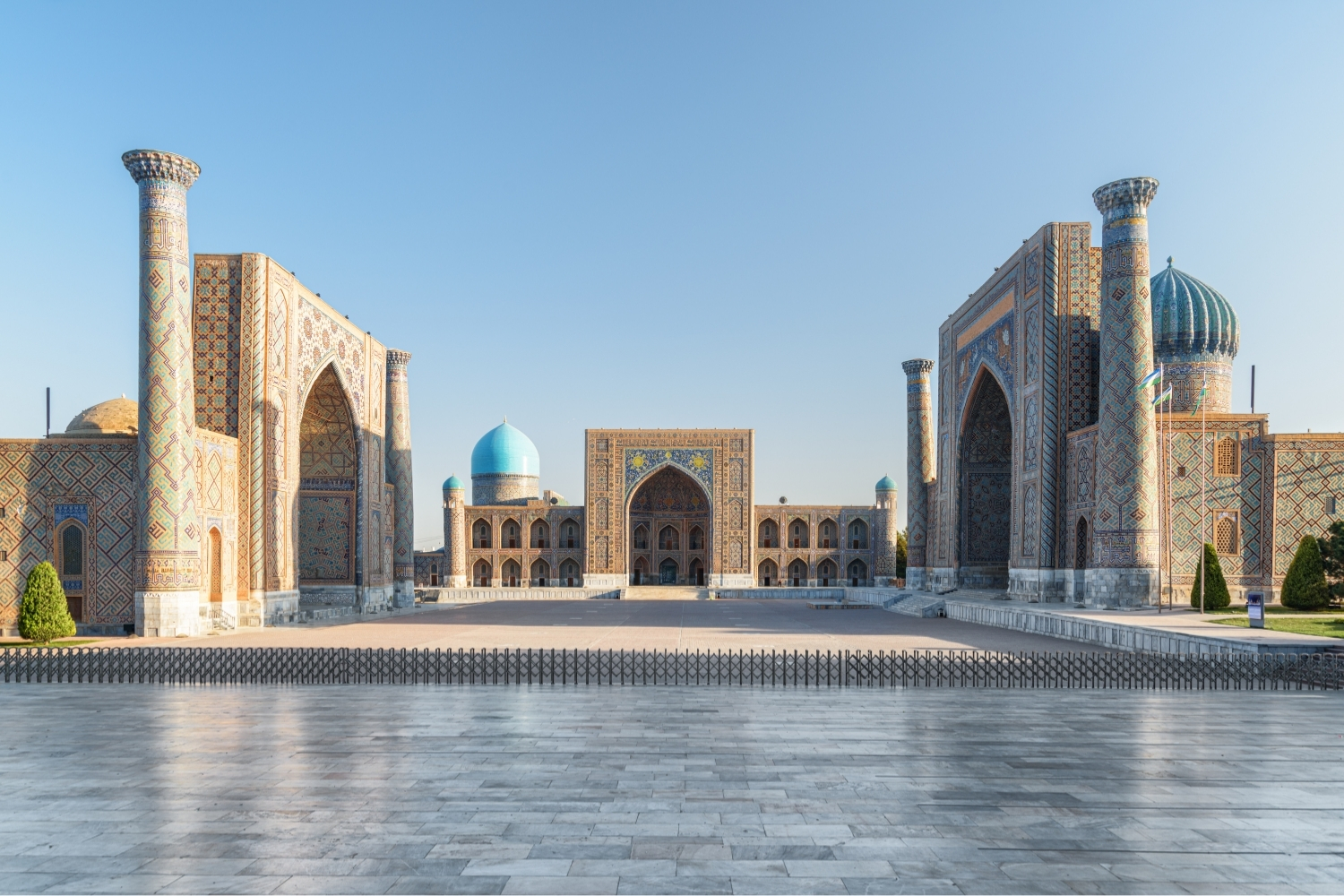
Table of Contents Show
Registan Square is the monumental public plaza at the center of Samarkand, Uzbekistan, where three madrasas built between the 15th and 17th centuries face each other across a brick-paved courtyard. The ensemble, a UNESCO World Heritage Site since 2001, stands as one of the clearest surviving examples of how Timurid rulers used architecture to project political power, intellectual ambition, and religious identity through the design of a single urban space.
The Origin of Registan Square and Its Timurid Roots
The word “Registan” comes from the Persian for “sandy place,” a name that originally described the open ground where caravans gathered near Samarkand’s commercial center. Under Timur (Tamerlane) and his successors, this informal trading ground was reshaped into a formal civic square, surrounded by markets, caravanserais, and a khanaqah (Sufi hospice). The earliest surviving structure on the square, the Ulugh Beg Madrasa, was built between 1417 and 1420 by Timur’s grandson, the astronomer-ruler Ulugh Beg. His project was part of a larger urban vision that included mosques, bazaars, and a bathhouse, though only the madrasa survives from that phase.
Samarkand occupied a central position on the Silk Road trade network, connecting China, Persia, India, and the Mediterranean. The city’s position made it a crossroads of architectural traditions, and Timur actively imported craftsmen from conquered territories to build his capital. Persian tile workers, Anatolian stonecutters, and Indian engineers all contributed to the visual language that defines Registan Square today.
The Three Madrasas: Architecture on Three Sides of a Square
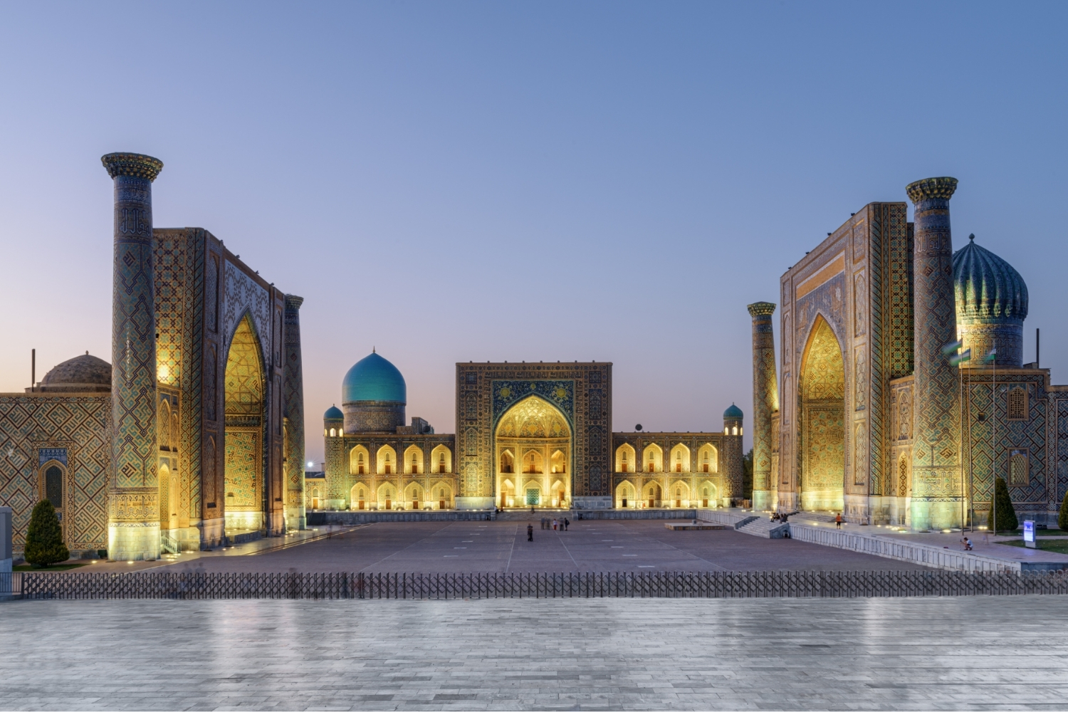
What makes Registan Square unusual among Islamic architectural ensembles is its spatial logic. Three madrasas, built over a span of roughly 240 years, face inward toward a shared open courtyard, creating a contained outdoor room that functions simultaneously as a public gathering space, a ceremonial stage, and a demonstration of dynastic continuity.
Ulugh Beg Madrasa (1417-1420)
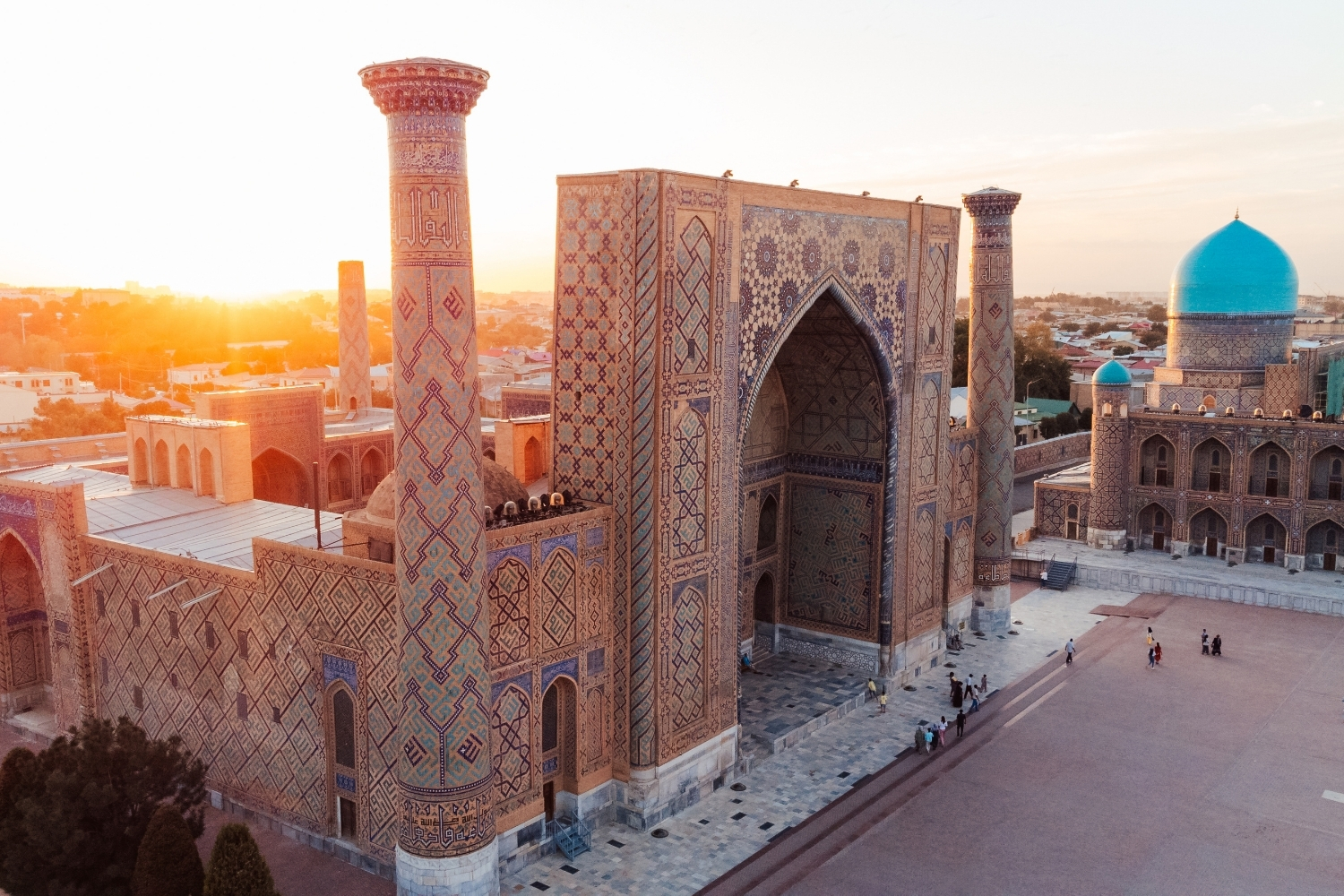
The oldest and most architecturally restrained of the three, the Ulugh Beg Madrasa occupies the western side of the square. The rectangular structure measures 81 by 56 meters and is organized around a central courtyard with four iwans (vaulted halls open on one side). Fifty student rooms (hujras) are arranged on two stories around this courtyard, with lecture halls beneath the corner domes and a mosque at the rear. The entrance is marked by a massive pishtaq (entrance portal) roughly twice the height of the flanking walls, a proportion that became standard in later Timurid and Mughal architecture.
Ulugh Beg was himself a practicing astronomer and mathematician who reportedly taught classes in the building. The star motifs on the portal’s mosaic tilework are thought to reference his astronomical interests. The history of Islamic architectural development shows how madrasas of this period served not only as religious schools but as centers for scientific study in mathematics, logic, and philosophy.
📐 Technical Note
The Ulugh Beg Madrasa’s pishtaq portal rises to approximately 35 meters, while the flanking walls sit at roughly 17-18 meters. This near-2:1 ratio between portal and wall height became a defining proportion in Central Asian madrasa design, later replicated in Bukhara, Khiva, and Mughal India. The building’s four corner minarets are cylindrical and slightly tapered, a form distinct from the pencil minarets of Ottoman architecture.
Sher-Dor Madrasa (1619-1636)
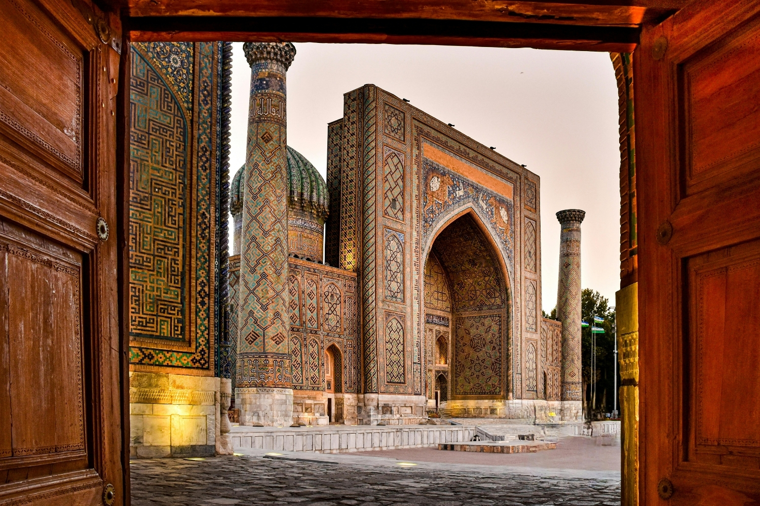
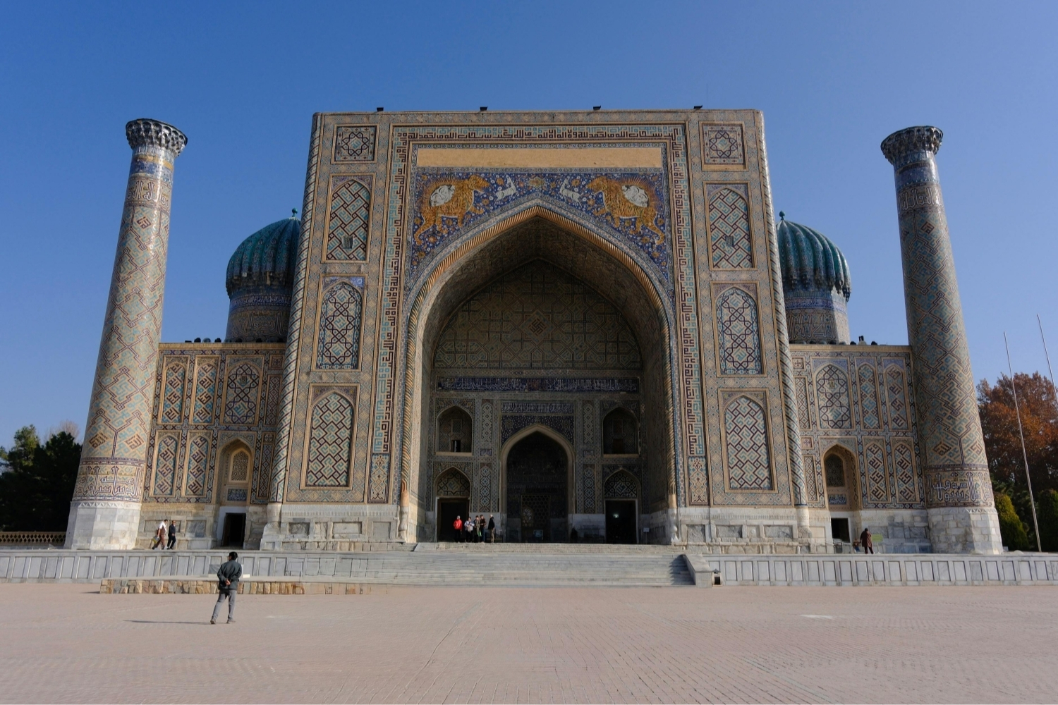
Directly opposite the Ulugh Beg Madrasa, the Sher-Dor (“Lion-Bearing”) Madrasa was commissioned two centuries later by Yalangtush Bahadur, the Ashtarkhanid governor of Samarkand. It was built on the site of Ulugh Beg’s original khanaqah. In plan and scale, the Sher-Dor closely mirrors the Ulugh Beg Madrasa, a deliberate decision to maintain the square’s symmetry.
The building’s most discussed feature is its portal mosaic showing two lions (or tigers) chasing deer beneath a radiant sun with a human face. This imagery is highly unusual in Islamic architecture, which generally avoids figural representation in religious buildings. The Sher-Dor’s lions are often interpreted as a political statement by Yalangtush Bahadur, associating his rule with royal power symbols that predated Islamic convention in Central Asia.
🎓 Expert Insight
“The Registan is the noblest public square in the world. I know of nothing in the East approaching it in massive simplicity and grandeur.” — Lord Curzon, British Viceroy of India (1899)
Curzon’s assessment, recorded during his travels through Central Asia, helped bring Registan Square to Western scholarly attention at a time when the buildings were in advanced decay. His comparison placed the ensemble alongside European civic squares as a work of urban design, not merely religious architecture.
Tilla-Kari Madrasa (1646-1660)
The third and final structure, the Tilla-Kari (“Gold-Covered”) Madrasa, closes the northern side of the square. Also commissioned by Yalangtush Bahadur, it is a square structure measuring approximately 75 by 75 meters. Unlike the other two, the Tilla-Kari doubles as a congregational mosque, with a domed prayer hall on its western side. The interior of this dome is covered in gold-leaf painting (kundal) applied over papier-mâché relief, creating an optical illusion of a three-dimensional vaulted ceiling on what is actually a flat surface.
The Tilla-Kari completed the enclosure of Registan Square, transforming it from an open-sided urban space into a defined architectural room. This spatial closure is significant in the context of how public spaces shape urban life; the square became a space where the city’s ceremonial, educational, and commercial functions converged under a single architectural frame.
How Did Timurid Design Shape Registan Square?
Timurid architecture drew on Persian, Central Asian, and imported traditions to create buildings of exceptional scale and surface richness. Several design principles are visible at Registan Square that define this period.
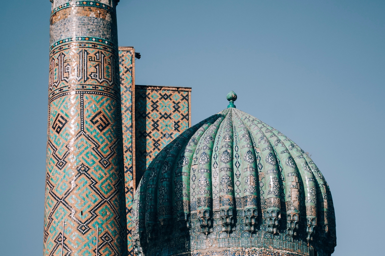
First, the use of glazed tilework as a primary surface material. The madrasas are covered in polychrome tile mosaics (primarily blue, turquoise, white, and gold) using two techniques: cut tile mosaic (where individual pieces are shaped and fitted into geometric patterns) and painted majolica tile (where patterns are painted onto pre-fired tiles). The blue coloring comes from cobalt oxide, sourced from mines in the region. This emphasis on surface over structure is characteristic of Timurid architecture and distinguishes it from the stone-based traditions of Gothic architecture in Europe.
Second, the iwan-courtyard plan. All three madrasas follow a four-iwan layout organized around a central courtyard, a spatial arrangement that originated in pre-Islamic Persian architecture and became the standard plan for mosques, madrasas, and caravanserais across the Islamic world. The iwans provide shaded gathering spaces, while the open courtyard allows light and ventilation into the surrounding rooms.
Third, the pishtaq as urban marker. Each madrasa’s entrance portal is deliberately oversized relative to the building behind it, functioning less as a functional doorway and more as a billboard facing the public square. The pishtaqs carry the most elaborate tilework and calligraphy, and their scale ensures they are legible from across the square, roughly 60-70 meters away.
🏗️ Real-World Example
Bibi-Khanym Mosque (Samarkand, 1399-1404): Built by Timur himself just 500 meters north of Registan Square, the Bibi-Khanym was one of the largest mosques ever attempted in the Islamic world at the time, with a main portal measuring over 35 meters high. Its structural failures (the dome and walls began cracking within decades) taught Timurid builders the limits of scale, and the more conservative proportions of the Registan madrasas reflect those hard lessons.
Registan Square as a Model of Islamic Urban Space Design
Beyond the individual buildings, Registan Square is significant as a piece of urban design. The square functions as an outdoor room defined by three monumental facades, with the open fourth side originally connecting to the city’s bazaar district. This arrangement created a controlled sequence of spatial experiences: a visitor approaching from the narrow market streets would suddenly enter a vast, open, light-filled space framed by towering blue-tiled facades.
This principle of spatial compression followed by release is a recurring strategy in Islamic urbanism, visible in contexts from the Alhambra’s courtyard sequences to the Ottoman külliye complexes. At Registan, the effect is amplified by the square’s sheer scale, estimated at roughly 60 by 80 meters of open ground, and by the reflective quality of the glazed tile surfaces, which shift in color and brightness as the sun moves across the sky.
The square also served practical civic functions beyond education and worship. Historical accounts describe it as a site for public announcements, royal processions, military reviews, and even executions. The UNESCO World Heritage designation recognizes this dual role, noting the ensemble’s value both as individual architectural achievements and as a unified urban composition.
The Bigger Picture
Registan Square survives not because it was preserved as a museum, but because each generation of rulers found it useful to build next to what already stood there. Yalangtush Bahadur could have demolished Ulugh Beg’s madrasa and started fresh; instead, he mirrored it. That instinct, treating existing architecture as a frame to extend rather than replace, produced something no single patron could have planned: a public space that records 240 years of political change in the geometry of three facades facing the same patch of ground. For architects thinking about how buildings relate to the spaces between them, the Registan remains one of the clearest arguments that urban design is a conversation across centuries, not a single statement.




The Great Wall of China: History, Architecture, and Enduring Legacy
A detailed architectural exploration of the Great Wall of China covering its...
 Furkan Sen7 Mins read
Prague Architecture: How Charles Bridge and Prague Castle Built Bohemian Gothic
Charles Bridge and Prague Castle explained as architecture: the 1357 bridge under...
Furkan Sen6 Mins read

Sultan Ahmed Blue Mosque: Ottoman Architecture’s Six Minarets
Six minarets made the Sultan Ahmed Mosque famous and controversial, but the...
 Elif Ayse Sen9 Mins read
Mimar Sinan and the Suleymaniye Mosque: Inside an Ottoman Masterpiece
Mimar Sinan built the Suleymaniye Mosque between 1550 and 1557 and called...
Furkan Sen7 Mins read


Leave a comment