

PLNAR Review: Does AR Measurement Hold Up on a Real Site Visit?
PLNAR began as a consumer AR tape measure and now runs as an insurance claims platform. This review covers the capture workflow, measurement tolerance against USIBD accuracy levels, the missing CAD export path, and who it still suits on site.
 Sinan Ozen28 August 20265 Mins read147
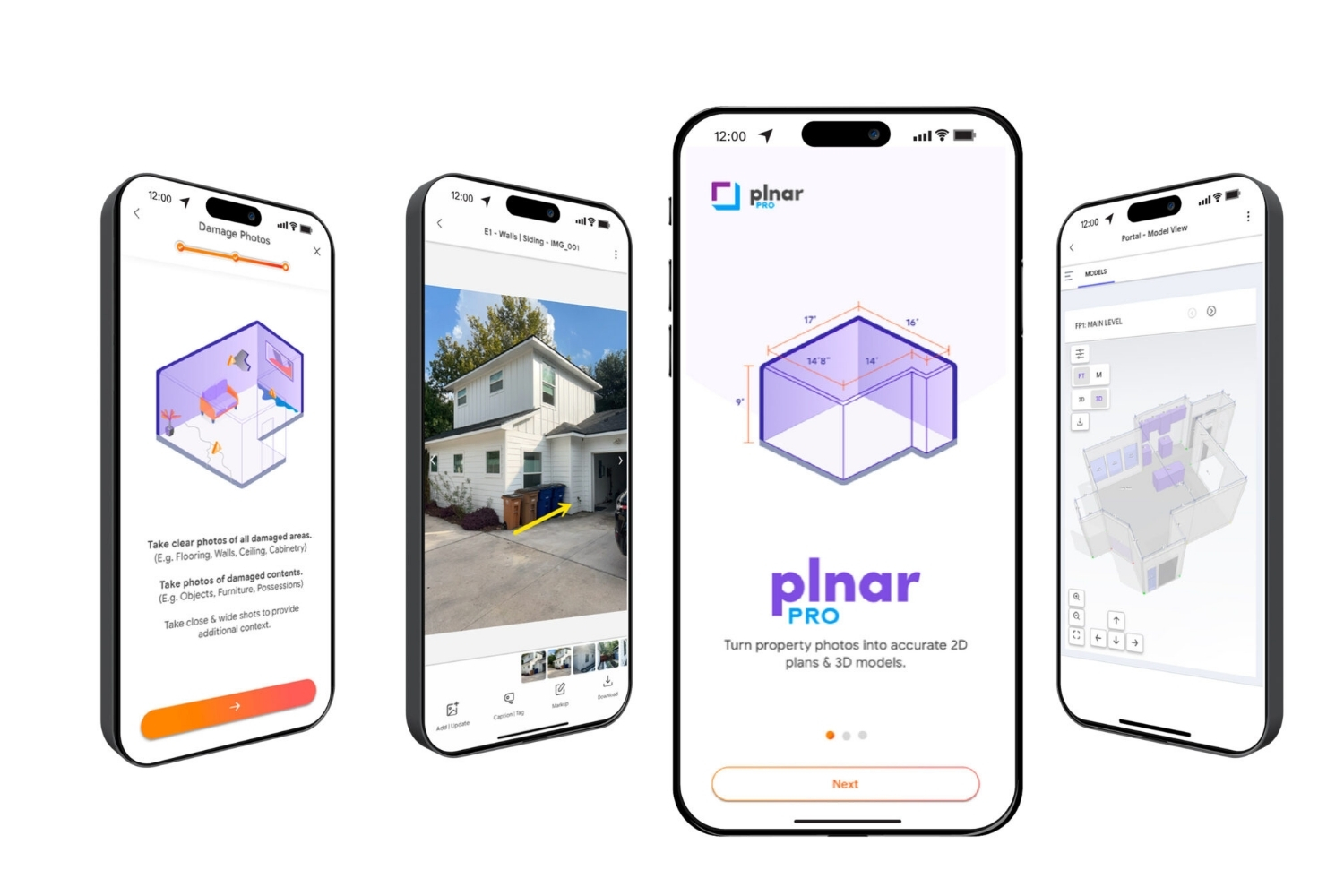
Table of Contents Show
PLNAR is an AI-powered smartphone capture platform that turns photographs of an interior into measured 2D and 3D models. This PLNAR review looks at how it performs on architectural site visits, where its accuracy sits next to laser survey, and why its insurance-first output pipeline matters for design teams.
Most tool reviews still treat PLNAR as the consumer augmented reality measuring app it was in 2017. That version of the story is out of date. The product an architect meets today was rebuilt for property claims, and that single fact decides whether it belongs in your field kit or not.

What PLNAR Is Built to Do Now
PLNAR is made by Smart Picture Technologies, an Austin company that has been working on photo-based spatial capture since 2012. The original iPhone app arrived alongside Apple’s ARKit and let anyone outline a room, place doors and windows, and export a dimensioned report. It was genuinely early, and it is still listed on the App Store.
The company now trades as Plnar at plnar.ai, and its published product line points squarely at property insurance: Plnar Pro for field professionals, Plnar Spatial for desk-based modelling, and Plnar Complete for outsourced estimating. Room measurement is still the engine underneath, but the packaging, the integrations, and the support are all built around claims work rather than design work. If you want a wider view of where this category sits, illustrarch has covered augmented reality apps for architecture in more detail.
🔢 Quick Numbers
- Plnar Pro launched on 15 October 2024 as a dedicated app for field professionals (Plnar press release, October 2024)
- The app reached version 1.7.321 in March 2026, with capture and reporting updates shipping steadily through 2025 (Apple App Store version history)
- Plnar Pro holds a 4.4 average from 7 ratings, while the older consumer PLNAR app shows 4.5 from roughly 1,400 ratings (Apple App Store listings, July 2026)
- Smart Picture Technologies has operated the platform from Austin, Texas since 2012 (CB Insights company profile)
How the Capture Actually Works on Site
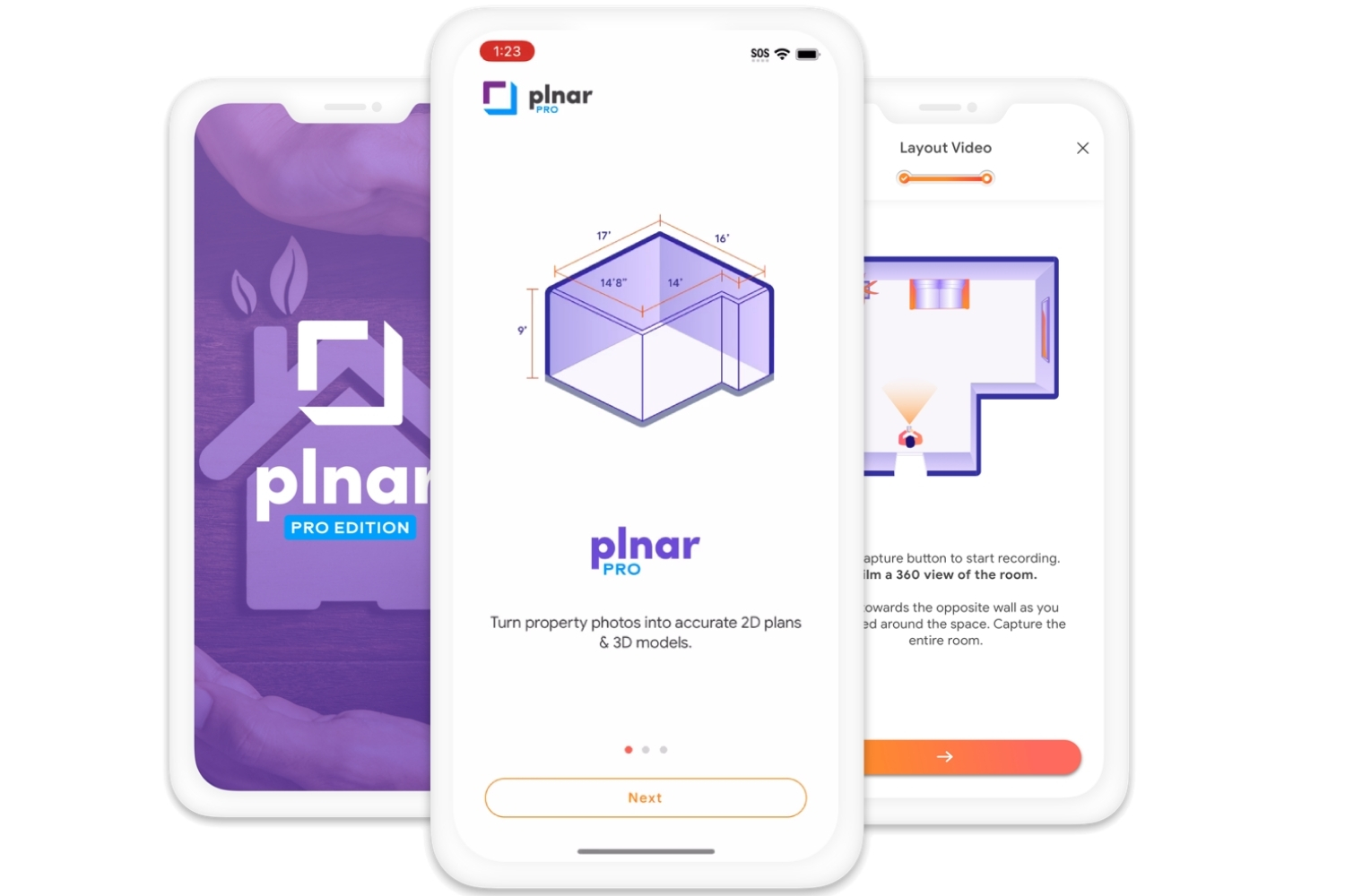
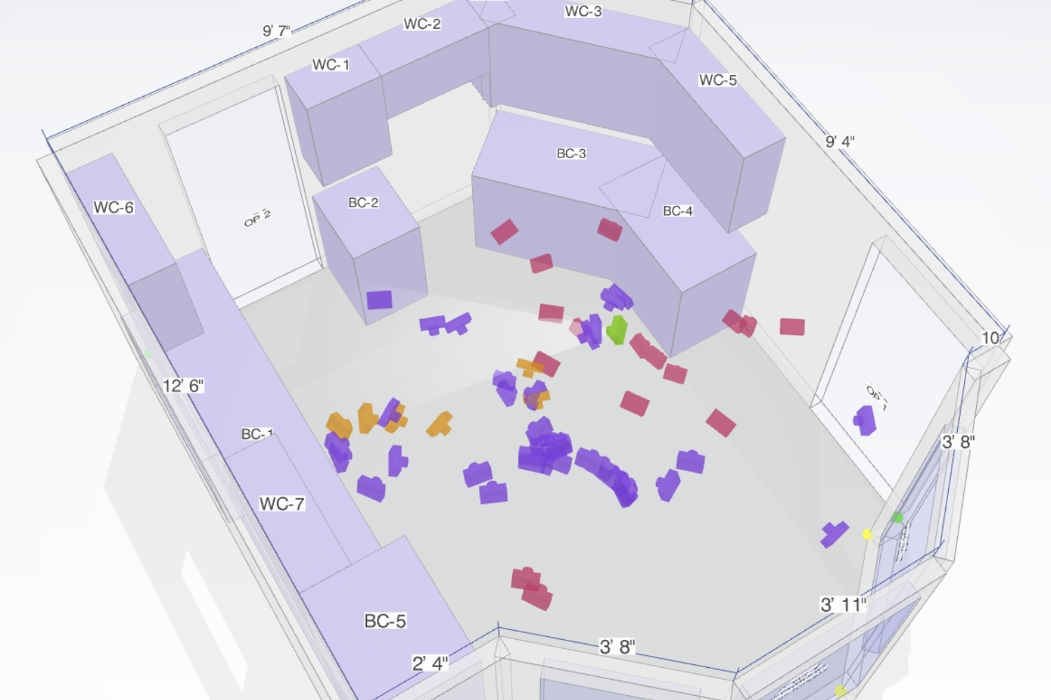
Plnar Pro does not ask you to trace walls with a live AR reticle. You follow a guided sequence of photos and short video sweeps, room by room, and the reconstruction happens in the cloud. Measurements, a 3D model, 2D schematics, and elevation-by-elevation floor plans come back attached to the project.
The practical consequence is hardware freedom. The listing requires only iOS 15.6 or later, so a standard iPhone works. Compare that with tools built on Apple’s RoomPlan framework, which needs the LiDAR scanner found on Pro-line devices. If your team carries mixed hardware, or you hand capture over to a client or site contact, that difference is worth real money. A December 2025 update added guest access through a shared link, so someone on site can capture a space without an account at all.
💡 Pro Tip
Photo-based reconstruction lives or dies on corners. Plnar’s own August 2025 release notes describe tuning corner angle recognition and extending video capture timing for complex geometry, which tells you where the system struggles. On site, slow down at every internal and external corner, keep the floor-to-wall junction visible, and shoot a bay window or an angled wall from two positions rather than one sweep.
How Accurate Is PLNAR for As-Built Work?
Accurate enough for scoping and area take-offs, not accurate enough to draw construction documents from without verification. Plnar publishes a customer testimonial from West Bend Insurance in which a claims director reports measurements “within one inch of contractor’s measurements” at roughly half the time of manual laser work.
Any PLNAR review that stops at the vendor’s number misses the harder question. That figure is a vendor-published testimonial, not an independent benchmark, and user reviews of the older consumer app point at the same weakness every photogrammetric method has: points drift as you work around a space, and the larger the room, the more the error compounds. Terrestrial laser scanning sits in an entirely different band, delivering roughly ±3 mm precision, as covered in illustrarch’s guide to LiDAR for renovation projects.
📐 Technical Note
The U.S. Institute of Building Documentation publishes the Level of Accuracy Specification, updated to version 3.1 in January 2025, which sets five tiers from LOA10 through LOA50 covering tolerance bands of roughly 50 mm down to about 1 mm. Smartphone photo capture belongs at the coarse end of that scale. Write the required LOA into your existing-conditions scope before you choose a capture method, and the tool decision answers itself.

How Does PLNAR Compare With Magicplan and Polycam?
The dividing line is where the data goes afterwards. Plnar’s published outputs are tuned for estimating platforms such as Verisk and CoreLogic, with an ESX file for claims software. A DWG, DXF, or IFC route is not listed on the current product pages, which is the single biggest obstacle for a design office. Magicplan exports DXF, and Polycam exports layered DXF that opens in AutoCAD or Revit with rooms and openings on named layers, according to the Polycam export documentation. Our full Magicplan review covers that workflow in depth.
Comparison of PLNAR, Magicplan and Polycam
The table below sets the three tools side by side on the points that decide a site visit workflow:
| Feature | Plnar Pro | Magicplan | Polycam |
|---|---|---|---|
| Capture method | Guided photo and video, cloud AI reconstruction | AR camera scan, LiDAR, Bluetooth laser | LiDAR room scan and photogrammetry |
| Device requirement | iOS 15.6 or later, no LiDAR needed | AR on iOS, laser meter on Android | LiDAR iPhone or iPad Pro for floor plans |
| CAD export | Not listed on current product pages | DXF | Layered DXF on paid tiers |
| Estimating handoff | Verisk and CoreLogic integrations, ESX file | Direct Xactimate integration | Image underlay for manual tracing |
| Pricing visibility | Quote based, demo required | Plan based, rates on request | Published subscription tiers |
| Best suited to | Claims, inspection and condition reporting | Contractors, adjusters, restoration teams | Design teams needing model and plan files |
For a broader survey of what else runs on a tablet in the field, see our roundup of the best apps for architectural plan drawing.
Pricing, Access, and the Practical Catch
Plnar Pro is a free download, which makes it look approachable. It is not a self-serve tool in practice. The product pages describe pay-as-you-go pricing but publish no price list, and the main routes in are a demo request or a signup that expects a business context. A single-office practice testing one project will spend more time in a sales conversation than in the app.
One more thing worth reading before you install: the App Store privacy panel lists precise location, photos and video, audio, and environment scanning among the data the app may handle. On a confidential client site, that list belongs in your decision, and it is worth confirming what leaves the building.
Pricing and plan structures for these tools change frequently and vary by region and account type. Confirm current terms directly with the vendor before committing.
Where to Go From Here
PLNAR earns its place if your practice sits close to insurance, restoration, loss assessment, or condition reporting, where the destination is an estimate rather than a drawing set. If your capture has to end up in Revit or AutoCAD, a LiDAR-based tool with a clean DXF path will save you a conversion problem you should not have to solve. Practices working at survey tolerance are still better served by the equipment covered in our guide to the best 3D scanners for construction.
Your Next Step: Before any tool goes into your workflow, capture one room you have already measured by hand, then compare wall lengths, ceiling height, and opening widths against your laser readings. That five-minute test tells you more about a measurement app than any PLNAR review, including this one.





Foster + Partners to Test Robot Swarms Building Timber from the Top Down
Foster + Partners wins €4m EU grant to build robot and drone...
 illustrarch Editoral Team2 Mins read
ArchiSnapper Review: Is This Field Report App Worth It for Architects?
A hands-on look at Deltek ArchiSnapper, the mobile app built for field...
Sinan Ozen5 Mins read

Gross Internal Area and Net Internal Area: What’s the Difference?
The difference between Gross Internal Area and Net Internal Area shapes how...
Sinan Ozen5 Mins read

How to Annotate Architectural Drawings Correctly: A Practical Guide
A practical walkthrough of how to annotate architectural drawings, covering the right...
Sinan Ozen9 Mins read


Leave a comment