

Tactical Urbanism: Examples, Methods and Impact
How cheap, reversible street projects become permanent change: the main tactical urbanism methods, eight documented examples from Bogotá to Barcelona with their numbers and setbacks, and how to measure a pilot.
 illustrarch Editoral Team7 November 202612 Mins read1
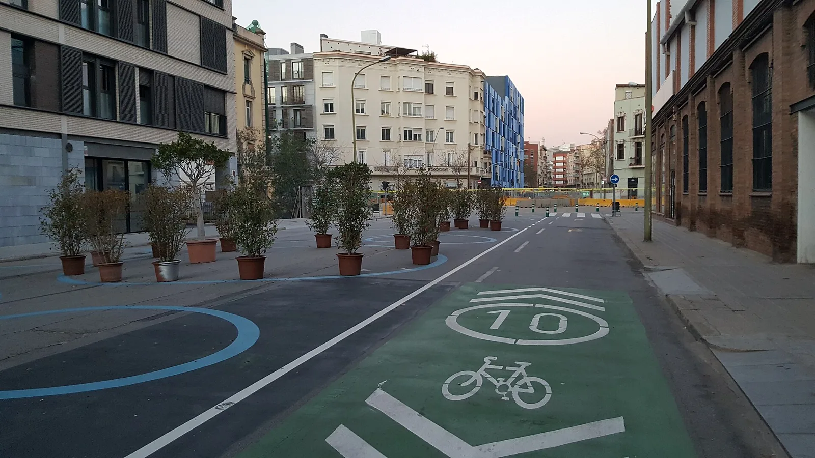
Table of Contents Show
Tactical urbanism is a way of changing streets and public spaces with short-term, low-cost and reversible projects, such as painted plazas, parklets or weekend street closures, that test an idea in real conditions before a city commits to permanent construction. If the test works, the data and public support it produces become the case for a lasting redesign.
Most of the street space in a modern city was handed to cars decades ago, and taking any of it back through a conventional capital project can take ten years of studies and hearings. The approach flips that order. You build a cheap version first, watch how people use it, count what changes and only then decide whether to pour concrete. The approach now has a name, a design manual and a track record, from a single parking space in San Francisco to a nine-block superblock in Barcelona. This guide explains what the term means, the methods practitioners use, eight real projects with their numbers and their failures, and how to judge whether a pilot actually worked.
What Is Tactical Urbanism?
The clearest working definition comes from The Street Plans Collaborative’s Tactical Urbanist’s Guide, which describes it as a city, organizational or citizen-led approach to neighborhood building that uses short-term, low-cost and scalable interventions to catalyze long-term change. The same page lists the other names the practice goes by: DIY urbanism, planning-by-doing, urban acupuncture and urban prototyping. Mike Lydon and Anthony Garcia of Street Plans also wrote the standard text on the subject, Tactical Urbanism: Short-term Action for Long-term Change, published by Island Press in 2015.
Three ideas separate tactical urbanism from ordinary temporary events. First, the project is a test of a specific permanent change, not a festival. Second, it uses materials that can be removed or adjusted quickly: paint, planters, flexible bollards, movable chairs. Third, it is measured. A street fair that ends on Sunday night and leaves no record is not a tactical project; a street closure with before and after counts is.
The approach grew as a response to the slow pace of conventional street projects and to the amount of land given over to traffic and parking, a pattern traced in our look at how cars reshaped urban space. It sits between activism and official planning, and the most interesting projects move from one side to the other.
🎓 Expert Insight
“It’s possible to change your streets quickly, it’s not expensive, it can provide immediate benefits, and it can be quite popular.” Janette Sadik-Khan, former New York City Transportation Commissioner
Sadik-Khan closed her 2013 TED talk on New York’s streets with this line, after describing how her department created more than 50 pedestrian plazas and repurposed 26 acres of car lanes. Her point is the core claim of the whole approach: speed and low cost are what make a street change politically possible.
Tactical Urbanism Methods: How Projects Are Built
The toolkit is small on purpose. Each method answers one question: what is the cheapest way to show a street working differently?
Demonstration projects and pop-ups
A demonstration lasts hours or days. Organizers set up a temporary bike lane, a pop-up shop or a block party, mostly to change the conversation. One weekend is too short to measure traffic, but it gives residents and officials a picture to react to.
Parklets
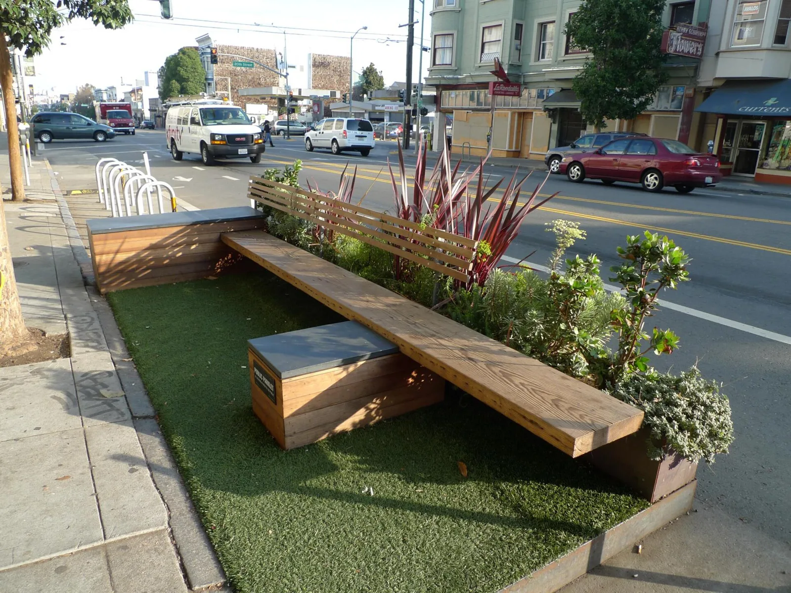
A parklet converts one or two curbside parking spaces into a small platform with seating, planting and bike racks. Parklets are cheap to build, easy to remove and usually maintained by a neighboring business or community group. San Francisco turned the idea into a formal permit that many other cities later adapted.
Paint and plastic plazas
Underused road space, often a skewed intersection or a slip lane, is closed with planters or flexible posts, painted, and furnished with movable tables and chairs. This is the method that made New York’s plaza program possible, and it is the most common form of city-led tactical urbanism.
Open streets
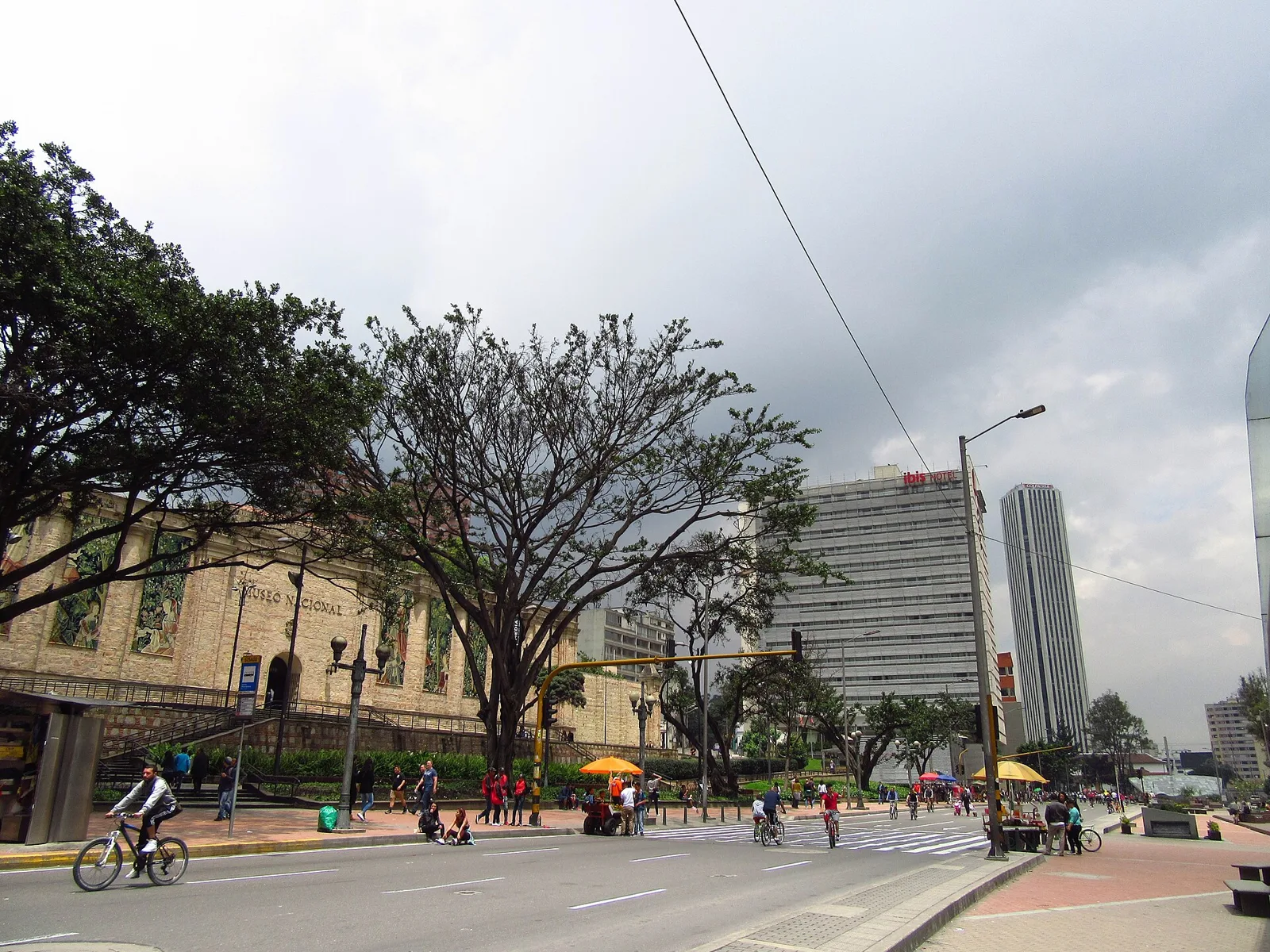
Open streets close a route to motor traffic on a regular schedule, usually Sunday mornings, so people can walk, cycle and play on it. The street returns to normal every week, but the repetition builds a habit and a constituency, as Bogotá has shown for five decades. The relationship between street space and movement is covered in more depth in our guide to urban mobility and design strategies.
Guerrilla versus sanctioned projects
Unsanctioned or guerrilla projects are done by citizens without permission: a painted crosswalk, a bench chained to a pole. Sanctioned projects are permitted or run by the city itself. Many well-known cases started on the guerrilla side and were later adopted by city hall, a path also visible in how Chinese cities have started to reuse leftover urban voids through temporary-use frameworks. Guerrilla work carries legal risk and can be removed overnight, so its main value is in proving demand.
1. Ciclovía (1974), Bogotá, Colombia
Started: 1974 | Run by: District Institute of Recreation and Sports (IDRD) | Scale: about 121 km of streets every Sunday and holiday
Ciclovía began in 1974 when a group of students and activists, with support from city officials, took over several Bogotá streets to ride their bicycles. In the 1980s it became a weekly program. According to a network analysis of Ciclovía published in a peer-reviewed public health study, the program now runs as a continuous circuit of about 121 kilometers, with attendance between 600,000 and 1,400,000 users every Sunday and holiday.
The reason it works is institutional, not just cultural. The same study maps more than twenty organizations involved, with the IDRD designing and running the route, the transport secretariat handling traffic detours and the metropolitan police supervising it. That network is what lets a city of millions close major roads every week without chaos.
The limitation is equally clear. Ciclovía is still temporary by design: the roads return to cars every Sunday afternoon, and the program shows what streets could be rather than changing them for the rest of the week.
2. Paris Plages (2002), Paris, France
Started: 2002 | Led by: Mayor Bertrand Delanoë | Scale: one month each summer on the Pompidou Expressway
The Voie Georges Pompidou was built in 1967 and ran along the right bank of the Seine for 13 kilometers. In the summer of 2002, a few months into his first term, Mayor Bertrand Delanoë closed it to cars from 6am to 11pm for a full month and turned it into Paris Plages, a temporary beach with sand, deck chairs and shade. The Congress for the New Urbanism’s account of the Pompidou Expressway notes that the closure was poorly advertised and drew criticism from car commuters, even though most Parisians approved of it.
What makes Paris Plages a tactical project rather than a summer event is what followed. The city repeated the closure every year until 2010, when Delanoë announced a plan to close the expressway permanently and turn it into a pedestrian zone. National government delayed the plan for two years; Prime Minister Jean-Marc Ayrault approved it in July 2012. According to the same CNU account, the redevelopment covered 35 acres of riverside at a cost of 50 million dollars.
Eight summers of beach turned a radical highway removal into something residents had already experienced.
3. PARK(ing) Day (2005), San Francisco, USA
Started: 16 November 2005 | Created by: Rebar | Scale: one 8 by 20 foot metered parking space
On 16 November 2005, members of the San Francisco art and design studio Rebar installed what the official PARK(ing) Day history calls the world’s first Park(ing) installation at 1st and Mission Streets, inside a single metered space measuring 8 by 20 feet.
The choice of site came from research, not whim. Rebar’s members had read the San Francisco parking code and concluded that nothing made it illegal to put something other than a car in a paid space. They also estimated that 20 to 30% of the city’s land area was streets, and that 70 to 80% of that street space, once sidewalks were excluded, served vehicle movement and storage. At curbside meter rates, a parking space was one of the cheapest pieces of downtown real estate available, and the installation made that bargain visible.
Rebar then published a how-to manual and invited anyone to copy the piece. The format spread to hundreds of cities and thousands of participants every year, each one repeating the same move: rent the space legally, then use it for people.
PARK(ing) Day is the clearest example of a demonstration project. It changed no rule on its own, but within five years San Francisco had written a permit for exactly this kind of space.
4. Times Square Pedestrian Plazas (2009), New York, USA
Started: 2009 | Led by: NYC Department of Transportation | Scale: about 2.5 acres of new pedestrian space on Broadway
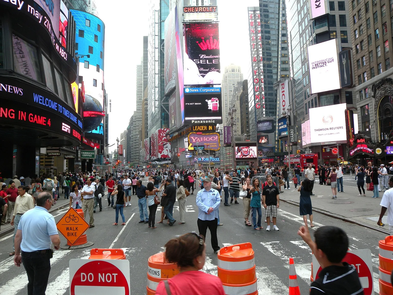
According to Sadik-Khan’s TED talk, about 350,000 people a day walked through Times Square on sidewalks too narrow to hold them. In 2009 her department ran a six-month pilot that closed Broadway to cars from 42nd to 47th Street, using orange barrels, paint and cheap lawn chairs to create about two and a half acres of pedestrian space.
The city then measured it. The Green Light for Midtown Evaluation Report of January 2010 found that pedestrian injuries in the project area fell 35%, injuries to motorists and passengers fell 63%, and 80% fewer pedestrians were walking in the roadway in Times Square. The same report is honest about mixed results: travel speeds varied widely, and bus speeds rose 13% on 6th Avenue but fell 2% on 7th Avenue.
Success did not end the debate. In August 2015, after complaints about costumed performers, Police Commissioner Bill Bratton suggested digging the plazas up, and Mayor Bill de Blasio said he would look at the option, as Streetsblog New York reported. The plazas stayed and were rebuilt in permanent materials, but the episode shows that a pilot’s data does not protect it from politics.
📌 Did You Know?
The cheap folding lawn chairs put out in Times Square in 2009 became the most discussed part of the project. Sadik-Khan recalled in her TED talk that reporters asked less about closing Broadway than about the color of the chairs, and drew a lesson from it: if you have a big, controversial project, think about lawn chairs.
5. Pavement to Parks Parklets (2010), San Francisco, USA
Started: 2010 | Run by: San Francisco Planning, SFMTA and Public Works | Scale: five pilot parklets in four neighborhoods
San Francisco’s Pavement to Parks parklet program brought together four city departments: the Office of the Mayor, the Planning Department, the San Francisco Municipal Transportation Agency and Public Works. Its first five pilot parklets were installed during 2010 in four neighborhoods, starting at 639 Divisadero Street.
The program’s key move was legal rather than physical. It defined parklets as temporary sidewalk extensions for use by the general public, a way to give narrow sidewalks room for seating where a permanent widening would be too slow or too expensive. That definition let a business host and pay for a parklet while keeping it public, and it turned PARK(ing) Day’s one-day protest into a standard permit.
The tension is in the same rule. Because businesses build and maintain most parklets, many people read them as private café seating, and cities that copied the model have had to post signs saying the seats are open to everyone.
6. Better Block (2010), Dallas, USA
Started: 10 April 2010 | Led by: Jason Roberts and Andrew Howard | Scale: one block for two days
On 10 and 11 April 2010, residents of the Oak Cliff neighborhood in Dallas took a car-oriented, four-lane street with restrictive zoning and turned one block into a working neighborhood street for a weekend. According to Team Better Block’s account of the original project, organizers set up three pop-up businesses (a coffee shop, a flower store and a children’s art studio) along with historic lighting and outdoor café seating.
The purpose was to expose rules, not to decorate. The organizers pointed out that city ordinances at the time made awnings, outdoor seating and live/work spaces difficult, so the temporary block was effectively a list of code changes Dallas would need. Jason Roberts and Andrew Howard went on to found Team Better Block, which says it has taken part in more than 150 Better Block projects worldwide.
7. Sunset Triangle Plaza (2012), Los Angeles, USA
Opened: 4 March 2012 | Designed by: Rios Clementi Hale Studios | Scale: about 11,000 square feet
Sunset Triangle Plaza closed a short stretch of Griffith Park Boulevard in Silver Lake and joined it to an existing pocket park. LADOT Livable Streets lists it as the City’s first pilot plaza, in place since 2012. The project came out of Streets for People, an initiative of the Los Angeles Planning Commission and the Los Angeles County Department of Public Health.
Rios Clementi Hale Studios painted the roughly 11,000 square foot surface with large green polka dots in two tones and lined it with planters that work as bollards, plus movable bistro tables. The firm and the commission presented the approach as a way to reclaim streets in months instead of decades and for thousands of dollars instead of millions. Sadik-Khan noted in her TED talk that Los Angeles even copied the green dots used on New York’s plazas.
The plaza also shows how stewardship works. The Silver Lake Improvement Association took on maintenance and programming, and the twice-weekly farmers market kept running. Design choices that make a space feel welcoming, from movable seating to clear edges, are explored in our article on keys to inviting public spaces.
8. Poblenou Superblock (2016), Barcelona, Spain
Started: September 2016 | Concept: Salvador Rueda, Urban Ecology Agency of Barcelona | Scale: nine city blocks, about 1,800 residents
Barcelona’s 2015 urban mobility plan adopted Salvador Rueda’s idea of superblocks: groups of roughly three by three blocks where through traffic is excluded and inner streets become shared space. The plan called for 500 of them. In 2016 the city’s architecture schools worked with Rueda on a first test in Poblenou, built with paint, tires laid out as play areas and potted trees, as Vox reported in its history of the Poblenou superblock.
It went badly at first. Flyers went out in July and the work was done in early September, so many residents simply woke up to rerouted traffic and buses. A local resident, Jordi Campins, founded a group of affected neighbors that held protests and drew heavy media coverage, and for about six months the project’s survival was in doubt. Critics also asked why a nine-block area with only about 1,800 residents was chosen at all.
The turning point was a second, better round of tactics. After consultation, the city added a permanent playground, planted green areas and installed picnic tables, and residents who had gained space organized to defend it. Poblenou is a reminder that a fast pilot without real engagement can backfire. Shared surfaces of this kind are discussed further in our guide to shared spaces in architecture.
Honorable Mentions
Aldo van Eyck’s Amsterdam playgrounds predate the term by decades, but the Dutch architect’s habit of turning leftover lots and street corners into small playgrounds is a clear ancestor of the approach. They are not in the main list because they were permanent municipal works, not tests. Read the full story of Aldo van Eyck’s 700 playgrounds.
Cidade 2000 in Fortaleza, Brazil, is one of the projects the Global Designing Cities Initiative uses in its five lessons on moving from pop-up to permanent: colorful ground markings, a learn-to-ride bike workshop and a pop-up barbershop made a wide asphalt area legible as public space. It sits here only because the published account gives no measured results.
The earlier Barcelona superblocks in the Born (1993) and Gràcia (2003) neighborhoods used raised, shared surfaces rather than temporary materials. A before and after study of Gràcia cited in the Vox history found foot travel up 10 percent, cycling up 30 percent and interior vehicle traffic down 26 percent. They are left out of the main list because they were built as permanent projects from the start.
What These Examples Have in Common
Read side by side, the eight projects show patterns that no single case makes obvious.
Reversibility buys consent
Times Square and Sunset Triangle Plaza both relied on materials that could be removed in a day, and that was the selling point. Sadik-Khan said in her talk that the temporary nature of the Times Square materials reduced anxiety because people knew the change could be undone. Paris Plages worked the same way: an annual beach was easier to accept than a highway removal.
Artists and citizens move first, cities write the rules later
PARK(ing) Day led to the Pavement to Parks permit within five years, and Better Block’s one weekend in Oak Cliff was explicitly a protest against specific ordinances. Ciclovía began with students and activists before the IDRD institutionalized it. In each case the formal program copied a citizen prototype.
Data decides what survives
The Times Square plazas survived a mayor’s doubts in 2015 partly because the 2010 evaluation had already published a 35% drop in pedestrian injuries. Ciclovía’s attendance figures and Gràcia’s traffic counts did similar work in Bogotá and Barcelona. Projects without published results, like Cidade 2000, are harder to defend and harder to copy.
Skipping engagement costs time
Poblenou nearly failed because residents were told too late, and Paris Plages drew commuter anger because it was poorly advertised. Both recovered, but each lost months. Fast does not have to mean unannounced.
Impact: How to Measure Whether a Pilot Worked
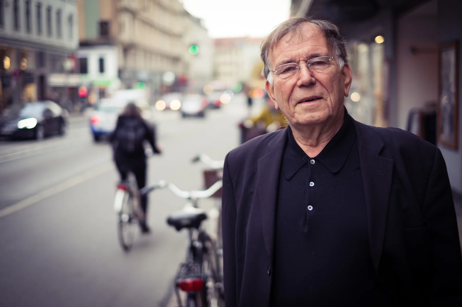
A tactical project is only as useful as the evidence it leaves behind. Before installation, record a baseline: pedestrian and cyclist counts, vehicle speeds and volumes, crash data for the previous three years, and a short intercept survey of people on the street and in nearby shops. Repeat the same counts at the same times during the pilot and again near its end. Public life counting methods developed by Jan Gehl’s office, recently celebrated in the Cities for People exhibition marking Gehl’s 90th birthday, are a good template for the observational side.
Report the bad numbers too. New York’s evaluation gained credibility by publishing the 2% drop in 7th Avenue bus speeds next to the safety gains. A pilot that only reports wins invites the suspicion that it was designed to win.
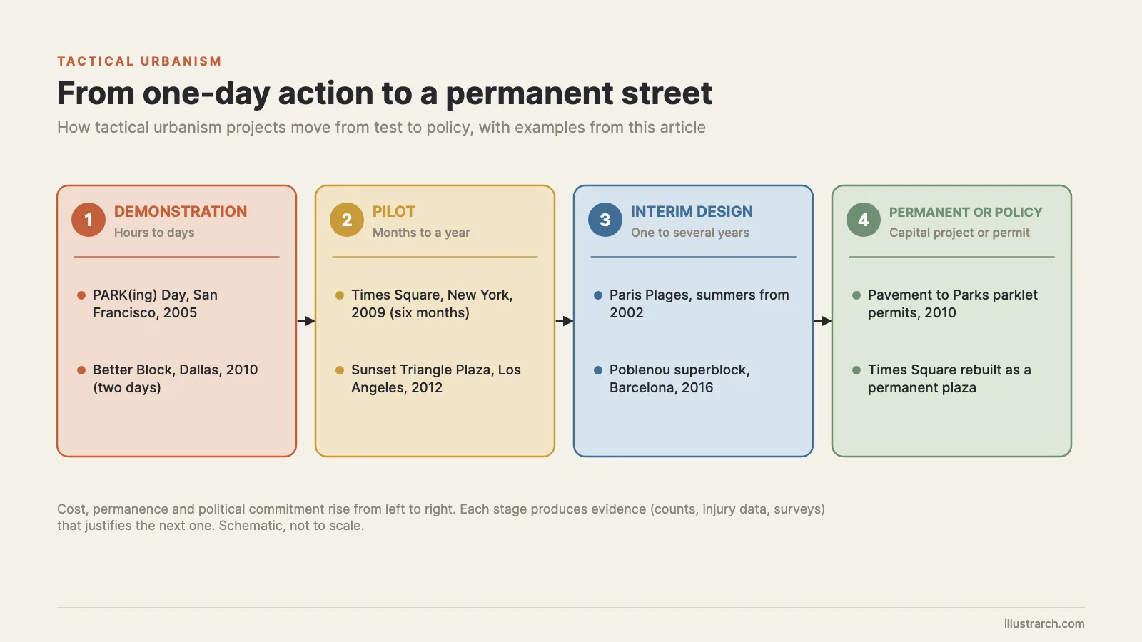
Finally, plan the exit before the entrance. Decide in advance what result would make the change permanent, what result would trigger an adjustment, and what would end the trial. That decision rule is what turns a pop-up into policy, and it is the step most often skipped.
🏗️ Real-World Example
Piazze Aperte (Milan, 2018): Milan’s open squares program, developed with Bloomberg Associates and the Global Designing Cities Initiative, began with Piazza Dergano and Angilberto II in 2018. A 2019 open call drew 65 proposals from more than 200 associations and 800 citizens, and by May 2022 the city had built 38 tactical squares, putting one in two residents within 15 minutes (800 meters) of one, according to GDCI’s summary of the Piazze Aperte report.
Wrapping Up
Quick Recap:
- Tactical urbanism tests a permanent street change with cheap, reversible materials before anyone builds it for real.
- The strongest cases, from Bogotá’s Ciclovía to Times Square, survived because they were measured and the numbers were published.
- Citizen prototypes such as PARK(ing) Day and Better Block often become official programs a few years later.
- Poblenou shows that skipping consultation can sink a good idea, even when the design is right.

Danish Architecture Center Marks Jan Gehl’s 90th Birthday with Cities for People Exhibition
DAC in Copenhagen celebrates Jan Gehl's 90th birthday with Cities for People,...
illustrarch Editoral Team2 Mins read
ZHA-Led Consortium Presents Benghazi 2050 City Planning Framework
A seven-firm consortium including ZHA presented a spatial plan and digital twin...
illustrarch Editoral Team2 Mins read

Ahmedabad Civic Body Plans 3D Digital Twin of Entire City
AMC plans a 625 sq km GIS survey giving 25 lakh properties...
illustrarch Editoral Team2 Mins read
Mixed-Use Development vs Single-Use Zoning: The Urban Planning Debate
Urban planning has long debated mixed-use development versus single-use zoning. This comparison...
 Sinan Ozen4 Mins read



Leave a comment